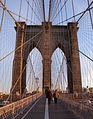
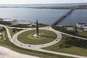
Long Island (basa Bali: Pulo Lantang) inggih punika nusa banua sané padet panjaknyané ring sisi kelod kangin negara wagian New York, sané nglimbak ngantos Samudra Atlantik. Puniki pinaka pahan sané ageng saking wawengkon métropolitan New York ring populasi miwah wewidangan tanah. Pulo puniki nglimbak saking Labuhan New York 118 mil (190 km) kangin nuju samudra antuk linggah kalér-kelod maksimum 23 mil (37 km).[2][3] Sareng jimbar wawengkon daratan 1,401 mil persegi (3,630 km2), puniki inggih punika pulo pinih ageng ring daratan utama Amérika Serikat.[4]

Long Island
Aran lokal:
Paumanok[1]
<mapframe>: Isi JSON bukan GeoJSON+simplestyle yang sah. Daftar ini menunjukkan semua upaya untuk menafsirkannya menurut Skema JSON. Tidak semuanya merupakan galat.
  • /0/query: The property query is required
  • /0/ids: The property ids is required
  • /0: Failed to match at least one schema
  • /0/title: The property title is required
  • /0/service: Does not have a value in the enumeration ["page"]
  • /0: Failed to match exactly one schema
  • /0/geometries: The property geometries is required
  • /0/type: Does not have a value in the enumeration ["GeometryCollection"]
  • /0/type: Does not have a value in the enumeration ["MultiPolygon"]
  • /0/type: Does not have a value in the enumeration ["Point"]
  • /0/type: Does not have a value in the enumeration ["MultiPoint"]
  • /0/type: Does not have a value in the enumeration ["LineString"]
  • /0/type: Does not have a value in the enumeration ["MultiLineString"]
  • /0/type: Does not have a value in the enumeration ["Polygon"]
  • /0/coordinates: The property coordinates is required
  • /0/geometry: The property geometry is required
  • /0/type: Does not have a value in the enumeration ["Feature"]
  • /0/features: The property features is required
  • /0/type: Does not have a value in the enumeration ["FeatureCollection"]
Genah Long Island ring negara wagian New York
Geograpi
GenahSamudra Atlantik
Koordinat40°48′N 73°18′W / 40.8°N 73.3°W / 40.8; -73.3
Jimbar1,376.1 sq mi (3,564 km2)
Titik paling tegehBukit Jayne
Pemerintahan
NegaraAmérika Serikat
Negara WagianNew York
Kota paling gedéBrooklyn, Kota New York (pop. 2,736,074)
Démografi
DemonimLong Islander
Krama8,063,232 diri (2020)
Kepadetan5,859.5 diri/mil persegi (2.2624 diri/km²)
Kelompok etnis54.7% Kulit Putih, 20.5% Hispanik utawi Latin saking ras napi je, 20.4% Selem, 12.3% Asia, 8.8% ras liyanan, 3.2% saking kalih utawi langkung ras, 0.49% panjak asli Amérika, lan 0.05% panjak pulo pasifik

Pustaka

uah
  1. Richmond Hill Historic Society Archived Méi 15, 2013, at the Wayback Machine Tributary tribes
  2. "Long Island Facts". LongIsland.com. Kaarsipin saking versi asli tanggal 5 Maret 2023. Kaaksés 23 Oktober 2022.
  3. "Long Island". Encyclopædia Britannica (édisi ka-Britannica Concise). Encyclopædia Britannica, Inc. 2011. 9370515. Kaarsipin saking versi asli tanggal November 5, 2007. Kaaksés April 30, 2011.
  4. John Burbidge (November 21, 2004). "Long Island at its Best; Who's the Longest of Them All?". The New York Times. Kaarsipin saking versi asli tanggal April 30, 2011. Kaaksés April 30, 2011. Nanging pangadilan nénten maosang Long Island nénten pulo ring teges géograpis", dane nglanturang. "Sujatinnyané, makasami pihak sané nyarengin ring kasus punika cumpu Long Island punika pulo géograpis. Wantah antuk tetujon kasus punika sané ngawinang pulo punika kadadosang panglimbak saking pasisi New York.