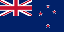
Selandia Anyar
Aksara Latin
|
Koordinat: 42°S 174°E / 42°S 174°E
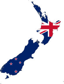
Selandia Anyar (basa Maori: Aotearoa) ento negara kapuloan merdéka di Samudra Pasifik. Ada duang pulo utama di negarané ento, Pulo Kaja (Te Ika a Māui) muah Pulo Kelod (Te Waipounamu), lantas kuang-lebih 600 pulo cenik. Selandia Anyar matongos kuang-lebih 2.000 km dangin Ostrali tur 1.000 km delod kapuloan Kalédonia Anyar, Fiji muah Tonga. Mapan guminé ento joh uli makejang gumi lénan, Selandia Anyar dadi silih tunggal gumi panyuud ané katongos tekén manusa. Krana Selandia Anyar mekelo tan pamanusa, ditu idup soroh buron muah punya ané tusing ada di gumi lénan.
Selandia Anyar | |
|---|---|
Semboyan: — | |
Lokasi Selandia Baru, termasuk pulau-pulau terpencil, klaim teritorialnya di Antartika, dan Tokelau | |
 | |
| Ibu kota | Wellington 41°18′S 174°47′E / 41.300°S 174.783°E |
| Kota pinih ageng | Auckland 36°51′S 174°46′E / 36.850°S 174.767°E |
| Basa resmi | |
| Kelompok etnik | |
| Agama |
|
| Demonim | New Zealander Kiwi (tidak resmi) |
| Pamréntahan | Kesatuan parlementer monarki konstitusional |
• Monarki | Charles III |
| Cindy Kiro | |
| Christopher Luxon | |
| Legislatip | Parlemen (DPR) |
| Kemerdekaan dari Inggris | |
| 6 Februari 1840 | |
| 7 Mei 1856 | |
• Dominion | 26 September 1907 |
| 11 Desember 1931 (efektif sejak 25 November 1947) | |
| Jimbarnyané | |
- Total | 268.021 km2 (103.483 sq mi) (75) |
| 1,6 | |
| Populasi | |
- Perkiraan Mal:Currentmonth Mal:Currentyear | Mal:Data New Zealand[2] (120) |
- Sensus Krama 2018 | 4.699.755[3] |
| 191/km2 (494.7/sq mi) (167) | |
| PDB (KKB) | 2022 |
- Total | |
| PDB (nominal) | 2022 |
- Total | |
| Gini (2022) | sedang |
| IPM (2021) | sangat tinggi · 13 |
| Mata uang | Dolar Selandia Baru (NZ$) ( NZD) |
| Zona waktu | beragam (UTC+12 sampai +13) |
| Wentuk pinanggal | dd/mm/yyyy |
| Lajur kemudi | kiri |
| Kode télépon | +64 |
| Kode ISO 3166 | NZ |
| Ranah Internet | .nz |
Situs web resmi www | |
| |


Ibukotan Selandia Anyar ento maadan Wellington, nanging kota paling gedé ditu maadan Auckland. Makadadua kota ento ada di Pulo Kaja.
Pustaka uah
Cutetan batis uah
Kutipan uah
- ↑ "2018 Census totals by topic – national highlights" (Spreadsheet). Statistics New Zealand. 23 September 2019. Kaaksés 26 February 2020. Check date values in:
|date=(help) - ↑ "Population clock". Statistics New Zealand. Kaaksés 14 April 2016. The population estimate shown is automatically calculated daily at 00:00 UTC and is based on data obtained from the population clock on the date shown in the citation.
- ↑ "2018 Census population and dwelling counts". Statistics New Zealand. 23 September 2019. Kaaksés 25 September 2019. Check date values in:
|access-date=, |date=(help) - ↑ 4,0 4,1 4,2 4,3 "World Economic Outlook Database, October 2022". IMF.org. International Monetary Fund. October 2022. Kaaksés 11 October 2022.
- ↑ "Household income and housing-cost statistics: Year ended June 2019". Statistics New Zealand. Table 9. Kaarsipin saking versi asli (XLSX) tanggal 24 February 2020. Kaaksés 24 February 2020.
- ↑ "Human Development Report 2021/2022" (PDF) (ring Inggris). United Nations Development Programme. 8 September 2022. Kaaksés 8 September 2022. Check date values in:
|access-date=, |date=(help)
Referensi uah
- Bain, Carolyn (2006). New Zealand. Lonely Planet. ISBN 1-74104-535-5.CS1 maint: ref=harv (link)
- Garden, Donald (2005). Stoll, Mark (ed.). Australia, New Zealand, and the Pacific: an environmental history. Nature and Human Societies. ABC-CLIO/Greenwood. ISBN 978-1-57607-868-6.CS1 maint: ref=harv (link)
- Kennedy, Jeffrey (2007). "Leadership and Culture in New Zealand". Ring Chhokar, Jagdeep; Brodbeck, Felix; House, Robert (eds.). Culture and Leadership Across the World: The GLOBE Book of In-Depth Studies of 25 Societies. US: Psychology Press. ISBN 978-0-8058-5997-3.CS1 maint: ref=harv (link)
- Hay, Jennifer; Maclagan, Margaret; Gordon, Elizabeth (2008). Dialects of English: New Zealand English. Edinburgh University Press. ISBN 978-0-7486-2529-1.CS1 maint: ref=harv (link)
- King, Michael (2003). The Penguin History of New Zealand. New Zealand: Penguin Books. ISBN 978-0-14-301867-4.CS1 maint: ref=harv (link)
- Mein Smith, Philippa (2005). A Concise History of New Zealand. Australia: Cambridge University Press. ISBN 0-521-54228-6.CS1 maint: ref=harv (link)
Pustaka liyanan uah
- Bateman, David, ed. (2005). Bateman New Zealand Encyclopedia (édisi ka-6). ISBN 1-86953-601-0.
- Sinclair, Keith (2000). A History of New Zealand. ISBN 978-0-14-029875-8. Unknown parameter
|coauthors=ignored (|author=suggested) (help) - Statistics New Zealand. New Zealand Official Yearbook (tahunan). ISBN 1-86953-776-9 (2010).
Pranala jaba uah
| Wikimédia Commons ngelah média sané matopik New Zealand / Aotearoa. |
- Pamrentahan
- Portal Pemerintah Selandia Baru Archived 2007-08-13 at the Wayback Machine
- Kementerian Kebudayaan dan Pusaka–termasuk informasi tentang bendera, lagu kebangsaan, dan lambang negara
- Statistik Selandia Baru
- Pariwisata
- Situs resmi pariwisata Selandia Baru
Wikivoyage madué panduan wisata New Zealand.
- Liyanan
- "Selandia Baru". The World Factbook. Central Intelligence Agency.
- Selandia Anyar ring Curlie
- Selandia Baru dari BBC News
- Te Ara, Ensiklopedia Selandia Baru
- NZHistory.net.nz Situs web Sejarah Selandia Baru
- Selandia Baru OECD
- Selandia Baru Archived 2008-06-07 at the Wayback Machine, direktori dari UCB Libraries GovPubs
- Selandia Baru di Encyclopædia Britannica
- Cuaca Selandia Baru
- Ramalan Kunci Pembangunan untuk Selandia Baru dari International Futures
- Peta New Zealand ring Wikimedia Atlas
Mal:Kelompok mal/geo Mal:Kelompok templat/org Mal:Kelompok mal


